About the Project
The Practical Mariner Project explores the ancient sailing world in the Mediterranean from the perspective of mariners and their practical needs. We compare and contrast wayfaring and place-making on either side of the 3.2Ky climate event, i.e. 1500-800 BCE, during which rainfall declined sharply and state-run networks unravelled under pressure from a range of social and political factors, only to re-emerge in an altered and greatly extended form. Processes of wayfinding are of particular interest: did new routes emerge out of knowledge exchange with fishing communities or the persistence of low-level local and regional trade?
Our team is combining agent-based modelling software with geographical information systems to animate the complex interaction between the carrying capacity of the land, the organisation of coastal communities and the practical requirement of sea-borne living. We integrate the availability of food, water, chandlery, and materials for repairs on land with the presence of fish in the sea in different seasons and different points in the agricultural and maritime cycles. Our aim is to assess the impact of climate change on sailing and fishing networks, particularly along the north African coast and on smaller islands across the Mediterranean.
Check out our online maps!
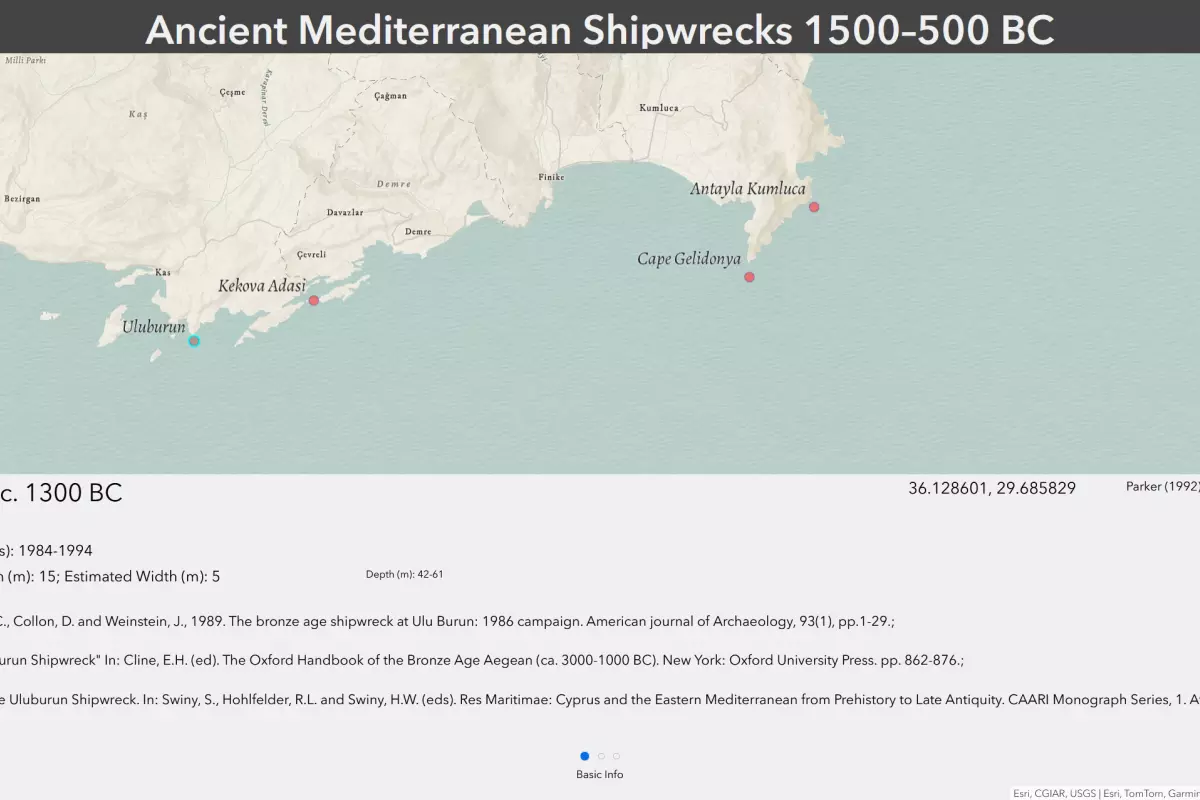
Ancient Mediterranean Shipwrecks 1500-500 BC